FAST FACTS |
HIGHLIGHTS OF UGANDA |
|
Size: 242,554 sq km
Capital: Kampala
Population: 24,699,073
Currency: Shs
Time: GMT+ 3hrs
Language: English, Bantu,
Nilotics, Madi - Muro,
Highland Nilotics
and Nilo - Hermits |
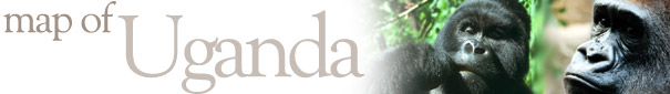
- Gorilla tracking
- Chimpanzee tracking
- Murchison Falls
- Sport fishing
- Bird Watching Safaris
- Forest Walks
- Mobile Camping Safaris
- White water rafting
- Trekking & mountaineering
|
- Bwindi Impenetrable Forest
- Queen Elizabeth NP
- Kibale NP
- Murchison Falls NP
- Rwenzoris NP
- Semliki NP
- Mgahinga Gorilla NP
- Ngamba Island Chimpanzee Sanctuary
- Kidepo Valley NP |
MAP OF UGANDA |
|
SUMMARY OF UGANDA
|
MAJOR CITIES AND TOWNS |
Highlights: Gorilla tracking, birding, trekking, white water rafting, mountaineering, fishing, boating & canoeing as well as sight seeing.
Best time to go: The best times to visit are December-March and June-September. It can be somewhat rainy then, but not as rainy as in the rainy season, March-June. December-February and June-July are the driest times, when things can even be a bit dusty.
Landscapes: The Nile, a source of wonder and inspiration for thousands of years, cuts a verdant and often turbulent median south to north through the country. It flows from Lake Victoria at what was Rippon Falls and into Lake Kyoga. Still the Victoria Nile, it cuts a raucous passage west across Karuma Falls and through the narrow pillars of Murchison Falls towards Lake Albert. Finally the Albert Nile meanders along a slow, wide corridor into Southern Sudan. To the far west of Uganda, on the Zaire border, the snow covered Rwenzori Mountains (or Mountains of the Moon as Ptolemy called them) rise into almost permanent equatorial mists. The mountain slopes have their own strange successive worlds of vegetation, each with its own characteristic flora. In the extreme south-west are the Mufumbiro volcanoes, a chain of imposing cones that rise out of the lava plain f the western rift. The tropical hardwood rainforests of Western Uganda such as Maramagambo, Budongo and Bwindi evoke adventure and wonder.
Cultures: The largest cultural group are the Baganda people, whose kingdom has always been influential in Ugandan affairs. Amongst our ethnic groups are many others that include those in the the Kingdom of Toro, the Banyankole, the Acholi, Basoga and Lugbara.
Weather: The majority of the country has a tropical climate which varies according to altitude. During the year the hottest months are from December to February when the temperature reaches 29 degrees Celsius. The rainy seasons are from April to May and October to November, with the wettest month being April. |
|
- Kampala
- Entebbe
- Jinja
- Kabale
- Kasese |
| |
|
|
|
DETAILED MAP OF UGANDA AND COUNTRY INFORMATION
|
|